Bloemfontein and surrounding areas remain on alert as another cutoff low-pressure system is expected to bring more rain, just days after persistent downpours left the city waterlogged and the ground heavily saturated, increasing the risk of localised flooding.
Here are a few photographs locals sent to Storm Report this week:
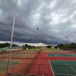
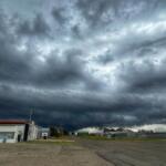

This is according to observations shared by storm chaser DJ Hefer, who says conditions remain concerning as the atmosphere continues to favour slow-moving weather systems. “Residents are advised to remain cautious, particularly in low-lying and flood-prone areas, as the risk of further localised flooding remains elevated,” he says, adding the incoming system could once again disrupt normal conditions.
The founder of Storm Report SA notes that while the heaviest rainfall is expected along the South Coast, inland areas such as Bloemfontein are not completely out of risk, particularly given the lingering moisture in the soil and slow drainage in urban areas. “Several suburbs recorded significant rainfall totals, including Hospitaal Park (66mm), Bayswater (64mm), Pellissier (63mm), Oubos (61mm), and Universitas (51mm).
While the rainfall provided some relief, the intensity and duration have led to increasingly saturated ground conditions, raising the risk of flooding.” Predictions are subject to change from the time of going to print on 6 May.